29 September 2013

Uphill Run on Transfagarasan

Transfagarasan is a spectacular mountain road that crosses the highest and the wildest mountains of the Romanian Carpathians: Fagarasi Mountains. The road reaches the upper glacial circus of Balea valley at an altitude of about 2050m, passing by the beautiful Balea mountain lake. Here a tunel under the main ridge of the mountains links the southern and the northern sections of the road. The road was built in the early 70's during the communist regime. It was meant to show the superiority of the communist system and the strength and glory of the "new man". Building it in the steep and wild mountains was a huge task. Many died during the construction and of course the regime tried to cover all the deaths.

The road was supposed to have an important strategical and economical value. However it is too high and steep to be an viable transportation link and moreover, the heavy snows of the mountains keep it closed for up to 8 months every year. Today, the spectacular Transfagarasan is just a popular touristic attraction. During the summer it is packed with tourists from all over Romania and abroad. It is the quickest way to get to the heart of Fagarasi Mountains.

On Friday, Sam, an enthusiastic mountain biker, asked me if I would join him on a day trip to Transfagarasan - by car to the base of the mountain, then by bike up to the highest point of the road, at Balea Lake. I hadn't plan anything special for the weekend, and this trip sounded good, especially that I wanted to do some kind of training for the comming Piatra Craiului Marathon which takes place in one week, on the 5th of October. My knees are tired after a summer with too much running so some sort of cross-training was just what I needed. However, after Sam told me that his wife is also joining and that she will drive the car the whole way up, I changed my plans and decided that I am going to run it uphill and then return with the car so I would not stress my knees too much.

We started from the southern end of Cartisoara Village at about 600m altitude. The road up to the lake is 25km long with almost 1500m of elevation gain. The winding road has a quite constant slope and is constantly going up for the whole route. The slope is not extreme so there are no special challenges for an experienced cyclist or trail runner.

We left Brasov at 6AM in the morning and two hours later we started the ascent of the mountain. The early hour meant that there were almost no cars on the road making me to enjoy the ascent a lot. It was quite cold and it got colder as we gained altitude. Luckily there was no wind and no rain. The cold weather was in fact perfect for running... I had no choice, but to keep going up in order to stay warm. There must have been just a few Celsius degrees above 0 on the high part of the route. As soon as I reached the top I rushed in the mountain hut to change my clothes with warm and dry ones and to have a cup of warm tea.

It took me 2h39 to complete the route, including several very brief stops for taking photos. Quite a good time - the cold weather helped it. I did not carry an GPS device, but I had recorded the track two years before when I did the same route on my bicycle. Here is the track that I recorded then:


Here are the photos of the day taken with an 6 years old compact camera that I have carried in my hand along the route.

On the first kilometer
Morning Blues...

First glimpse of the mountain
Motorists, be aware!
Half-tunnel
Glimpse of Balea waterfall 
Misty forest
A look back into the valley
Mountain graffiti
Step by step
The upper Balea Valley
Action! - A filming crew up here... they also have an helicopter!
One step closer to the goal
Balea valley
Danger! Drive carefully!
Mountain Snake
Last 100m!
Balea Mountain Chalet
Lake view
A pile of snow from an earlier September snow storm
Sam enjoying the downhill

18 September 2013

Ciucas Trail Marathon 2013

This Saturday I ran my fourth full marathon. I participated in the Marathon Race of the Ciucas Trail event. The event has three races. A half-marathon, a marathon and an 100km individual ultra-marathon. Last year I ran the half-marathon so this time and I wanted to do the full marathon race.

One month before the event I did a reconnaissance run on the marathon route; an illustrated description of the route can be found in an older post. Knowing the route meant that I did not have any orientation issues during the race. The trails were very well marked, except a few key crossroad points that could have been better signaled. Unfortunately a few of the best runners got lost and ended up doing a different route... not necessarily easier.

The weather was cold, wet and quite windy on the exposed mountain top. When I left Brasov in the morning it was raining heavily and I was mentally preparing myself for running in the cold pouring rain. Luckily the rain gradually eased and eventually stopped just before the race start! I ran with a thin merino wool shirt. I also had my running jacket with me and used it on the windy sections. At the end it wasn't that cold and the woolen shirt was a bit too much and got quite wet, but without causing too much discomfort.
On my way to Ciucas peak  - photo by Camelia Varsescu
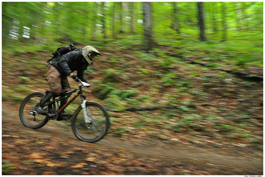
Once more, I ran the race without any watch or GPS device. I really like racing this way. I study the map before the race and I make a race plan. During the race I always have a good idea where I am and how to manage my energy. I also tried to run my own race, not paying too much attention to the other competitors. I did not want to get exhausted and also did not want to hammer my knees on the downhills. At the beginning of the race, in the forest, the trails were a bit muddy. However, much of the route had really good running conditions. The wet trails were better than during the reconnaissance run when they were very dry and dusty.

After the first 10 kilometers my place in the race stabilized. I am quite good on uphills so I almost caught up with a few runners on Ciucas top. However, soon, on the downhill they disappeared in the distance ahead of me as I was carefully running downhill. During the downhill I was expecting to be overtaken by several runners, but nobody did. Later I learned that just after I started my descent from the peak, it was covered in a thick fog so the next runners got lost in the fog for about 10 minutes. Actually after passing by Ciucas Hut one runner (Florin Simion) overtook me. He was ahead of me until the hut, but stopped there, while I decided to skip the hut stop on my way down to the finish line.

I finished with quite a good time: 4h52. Almost the same time as on the reconnaissance run, but that time I skipped a 5.5km section of the route that also included a long 300m elevation gain ascent. I could probably be 10 minutes quicker if I would have run faster downhill. I preferred however to be careful with my knees and to avoid slipping on the muddy sections. I managed to finish the 13th of the 168 competitors, and the 7th in my age category. Not a bad result, but many good runners were either absent from this event, or were running the ultra or the half marathon races.

I want to thank the organizers and the volunteers for the effort they spent to organize this event. It is not an easy task to manage three different races in the same day. The bad weather made it more difficult. I also know that they had some serious unexpected issues that made organizing the event even harder.

I am now concentrating on my last marathon of 2013. The famous and spectacular Piatra Craiului Marathon. See you there!

15 September 2013

Ghost Riders

No running today...  I ran enough yesterday as I competed in the 39km Ciucas Trail Marathon race. I will write about the marathon next days. So today I did a short recovery walk on the hills near Brasov. On the route I took photos of competitors in the On The Rocks mountain bike race. The race was a long 12km downhill from Postavarul Mountain to Brasov, with almost 1200m of altitude drop. It was the first edition of this contest on this route.

When I first heard about this contest I was quite worried, as it took place along some popular hiking trails. I am happy to report that the organisers did a very good job in keeping the safety standards high. Posters on the trees along the route announced the race 2-3 weeks in advance. On the day of the race, there were many volunteers along the route so any hiker could be warned. In the end the day was quite cold and cloudy so there were just a few hikers in the area. The race had a mass start so the whole event was a quick one causing minimal disruption along the trail.

As the sky was overcast, the forest was quite dark; not ideal conditions for taking action photos. So I experimented with panning and relatively long exposure times. I got a few very interesting photos, more on the 'artistic' side of photography. However, the majority of the photos will disappoint the racers as they are really shaky and blurry... Even so, I kept at least one photo of each biker and posted them on Picassa Web Albums. Here are some of the best photos of the day:


08 September 2013

Hike on Bucsoiu Peak

I have already hiked along Bucsoiu ridge and on Bucsoiu peak twice this summer. However, both times I was in a great hurry and had not much time to admire the landscape. I was there this June when training for Marathon 7500 and then in July during the Marathon 7500 race. I really wanted to do this scenic route again, but at a slower relaxed pace. Yesterday, the 7th of September was a really perfect day for a mountain hike, so I hit the trail together with my work colleague Vlad. It was a cold but sunny and windless day, with dry and clean atmosphere - just perfect to be high on the mountains!

Bucsoiu Peak is one of the most impressive peaks of Bucegi Mountains, dominating the north side of the Abrupt. The route along Bucsoiu ridge is quite demanding. It is rather steep, and has more than 1000m of elevation gain. It has a short steeper section around the middle of the way. As any steep trail, it is better suited for uphill. I would not recommend it on bad weather as the ridge is quite exposed. The trail is officially closed during the winter season. We returned on the adjacent Malaiesti valley, one of the most spectacular glacial valleys in Bucegi Mountains.

The track recorded during the hike:

Here are some photos I have taken along the way.

Bucsoiu Valley
We will follow the red stripe trail markings
View towards Barsei Land. In the distance, the round shape of Magura Codlei mountain
Half way to the top
Photo Break
In the distance Postavaru Mountain. Hidden behind it, Brasov, my home city.
Scara Peak (2422m)
View to the west. In the distance Piatra Craiului Ridge
Creasta Balaurului (Dragon's Ridge)
Below Bucsoiu Peak
Panorama view towards west
Looking down from Bucsoiu ridge to Malaiesti Valley
Bucsoiu Peak (2493m) 
A warning sign on the descent to Malaiesti Valley. 
Down on Malaiesti Valley
Malaiesti Mountain Hut (1700m)